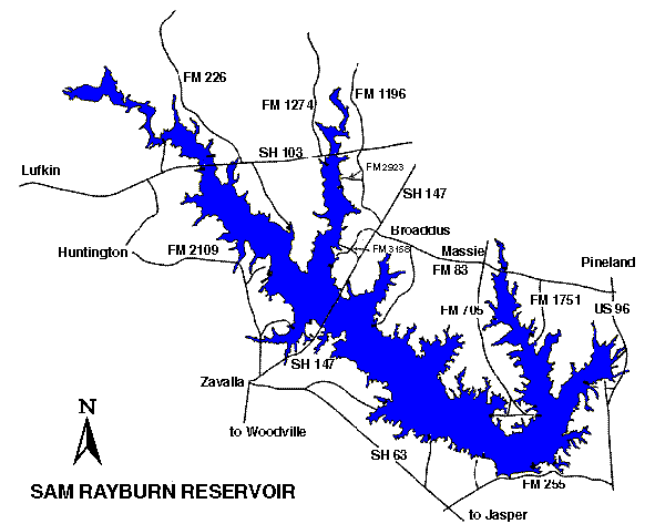
31°10.33N 94°14.83W
Neches River Group
114,500
surface acres
Depth
avg = 13 ft
max = 80 ft
Conservation Pool
164 ft MSL
VFR Sectional(s)
Houston
Unicom
122.90
- Landings and takeoffs prohibited west of Highway 147, north of Highway 83, and in scattered, uncleared areas of the reservoir.
- Maintain at least 500 feet from shore or structures during takeoffs and landings.
- Seaplanes may not be operated between sunset and sunrise.
- See advisory.
Fuel:
MOGAS -
Shirley Creek Park (936)854-2233
Jackson Hill Park (409)872-3551
Twin Dikes Park (409)698-2696
San Augustine Park (409)384-5716
Mill Creek Park (409)384-5716
Recreational Facilities:
Camping, picnic areas, restrooms, fishing, boat
ramps.
Reservoir Controlling Agency:
US
Army Corps of Engineers (409)384-5716
Sam Rayburn Project Office
RT. 3, BOX 486
Jasper, TX 75951
Other Links:
Texas
Parks and Wildlife