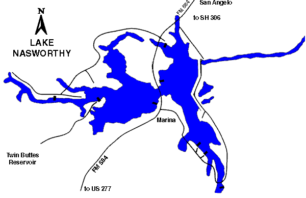
31°23.0N 100°29.5W
Colorado River Group
1,598
surface acres
Depth
avg = 4 ft
max = 29 ft
Conservation Pool
1,872 ft MSL
VFR Sectional(s)
San Antonio
CTAF
SJT TWR 118.30
Traffic Pattern Altitude: 2672 MSL all aircraft.
Landing lanes: 12-30 7,000 x 500.
Mooring facilities: ramp.
Fuel:
Fuel: prior req; contact 122.95; no transportation;
bring own cans.
Ranger Aviation
(915)949-3773, (800)326-5758 email
Skyline Aviation
(915)944-8858 email
Recreational Facilities:
Camping, fishing, picnic area, swimming, boat ramps.
Reservoir Controlling Agency:
City of
San Angelo
Public Works Department (915)657-4206
PO Box 1751
San Angelo, Texas 76902
Other Links:
Texas
Parks and Wildlife
Airnav