33°19.82N 95°37.65W
Sulphur River Group
19,280
surface acres
Depth
avg = 14 ft
max = 55 ft
Conservation Pool
440 ft MSL
VFR Sectional(s)
DFW
CTAF
122.9
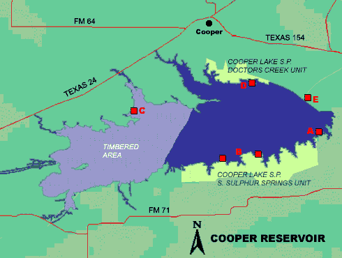
- Landings and takeoffs prohibited in the uncleared portion of the lake west of a line running from the west end of South Sulphur State Park to the peninsula at the mouth of Doctors Creek, and in the cove formed by Doctors Creek.
- Maintain at least 500 feet from shore or structures during takeoffs and landings.
- Seaplanes may not be operated between sunset and sunrise.
- See advisory
Fuel:
None reported.
Recreational Facilities:
Cooper
Lake State Park
Camping, picnic areas, fishing,
boat ramps, trails, restrooms, swimming.
Reservoir Controlling Agency:
U.S.
Army Corps of Engineers (903)945-2108
Cooper Dam
828 CR 4795
Sulphur Springs, Texas 75482
Other Links:
Texas
Parks and Wildlife
Wildernet